ST. LOUIS — British startup SatVu is proving that even a short-lived satellite mission can yield big business opportunities in the competitive remote-sensing sector. Despite the premature failure of its first thermal imaging satellite after just six months in orbit, the company has already signed up customers for its next satellite scheduled to launch later this year.
“We’ve actually got about $6 million worth of pre-orders already for HotSat-2, based on the data we got from HotSat-1,” Anthony Baker, SatVu’s CEO and co-founder, said in an interview with SpaceNews.
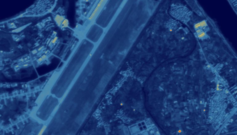
Unlike Earth observation satellites that capture images using visible light, SatVu’s HotSat satellites use thermal cameras to detect infrared radiation emitted by objects on Earth. This technology essentially creates a heat map of the planet, with different colors representing varying temperature levels across landscapes, buildings, and infrastructure.
In the crowded satellite imagery market, SatVu is carving a niche in high-resolution mid-wave infrared (MWIR) sensing. These sensors can detect heat signatures as small as 3.5 meters, enabling detailed analysis of individual buildings and infrastructure.
HotSat-1, launched in June 2023, was manufactured by Surrey Satellite Technology Ltd., a subsidiary of Airbus, which is also building HotSats 2 and 3. Surrey is “taking the appropriate actions” to avoid repeating the mechanical issue that crippled HotSat-1, Baker said.
The satellite’s failure came with a $10 million insurance payout — enough to keep the program moving forward, Baker said. And crucially, the data that was collected during those six months proved the technology’s value. Once customers saw what kind of insights were possible, he said, they recognized their commercial and strategic potential.
While thermal imaging isn’t new, few companies are operating in the MWIR spectrum at high resolution. According to a report from the Center for Strategic and International Studies, South Korean and Chinese constellations currently dominate this sector of the market.
Baker said SatVu has signed agreements with U.S. defense contractors involved in the National Geospatial-Intelligence Agency’s Luno program, which aims to integrate commercial satellite data into government intelligence workflows. “There’s demand not just from commercial players, but from the government itself,” Baker said. “They want a non-classified, commercial system they can use.”
With high-resolution thermal images, analysts can determine if a power plant or factory is running, and even estimate what kind of product it’s making — based solely on its thermal signature. That’s a powerful tool for defense analysts and economic forecasters, said Baker.
Despite the HotSat-1 setback, the mission provided enough real-world data to validate the technology’s potential, he added. “It gave real data, and that basically retires a lot of the risks for a lot of customers.”
SatVu’s long-term goal is to build an eight-satellite constellation that can provide daily global coverage.

